Polygon (gm-polygon)
In addition to rectangles, polylines, and circles you can also create polygons on a map.
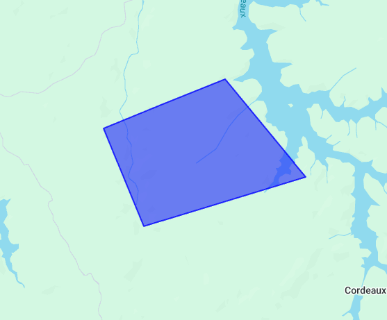
Simple Use (demo)
html
<template>
  <div style="height: 500px">
    <gm-map>
      <gm-polygon :paths="[{ lat: -28, lng: 125 }, { lat: -25, lng: 130 }, { lat: -32, lng: 120 }]" />
    </gm-map>
  </div>
</template>

<script setup lang="ts">
import { gmMap, gmPolygon } from 'v3-gmaps';
</script>
Props
| Props | Type | Default | Description |
|---|---|---|---|
| draggable | boolean | false | Whether this Polygon can be dragged over the map. |
| editable | boolean | false | Whether this Polygon can be edited by dragging the control points shown at the vertices and on each edge. |
| paths | GmPosition[] | GmPosition[][] | - | The ordered sequence of coordinates that designates a closed loop. |
| visible | boolean | true | Whether this Polygon is visible on the map. |
| options | google.maps.PolygonOptions | - | Google Maps PolygonOptions interface |
Events
| Event | Type | Description |
|---|---|---|
| click | GmPosition | This event is fired when the DOM click event is fired on the Polygon. |
| contextmenu | GmPosition | This event is fired when the DOM contextmenu event is fired on the Polygon. |
| dblclick | GmPosition | This event is fired when the DOM dblclick event is fired on the Polygon. |
| drag | GmPosition | This event is repeatedly fired while the user drags the Polygon. |
| dragend | GmPosition | This event is fired when the user stops dragging the Polygon. |
| dragstart | GmPosition | This event is fired when the user starts dragging the Polygon. |
| mounted | google.maps.Polygon | On mounted the component will emit the Google Maps object it represents. |
| mousedown | GmPosition | This event is fired for a mousedown on the Polygon. |
| mousemove | GmPosition | This event is fired for a mousemove on the Polygon. |
| mouseout | GmPosition | This event is fired for a mouseout on the Polygon. |
| mouseover | GmPosition | This event is fired for a mouseover on the Polygon. |
| mouseup | GmPosition | This event is fired for a mouseup on the Polygon. |
| paths_changed | GmPosition[] | GmPosition[][] | This event is fired when any of the Polygon's paths are changed. |
| rightclick | GmPosition | This event is fired for a rightclick on the Polygon. |
| unmounted | google.maps.Polygon | On unmounted the component will emit the Google Maps object it represents. |
Notes
- Unlike polylines, a polygon may consist of one or more paths. As a result, the paths property may specify one or more arrays of LatLng (
GmPosition) coordinates. - If you define the coordinates clockwise, the polygon will be shaded in. If you define the coordinates anti-clockwise, the polygon will remove shading.